Isle of Wight Nostalgia - Ventnor's lost Railways
Ventnor was lucky enough to have two railway termini for over half of the last century. They were built by different companies but were amalgamated by the formation of the Southern Railway in 1923. Following nationalisation in 1948, the railways transferred to the ownership of British Railways (Southern Region) until closure. Due to the geography of the town, being built as it is on the side of the downs, it was always going to be difficult to build a station close to the town. In fact both termini were placed inconveniently, one 294 feet above sea level and the other some distance to the west of the main area of population. The maps show the development of the town early during the last century.
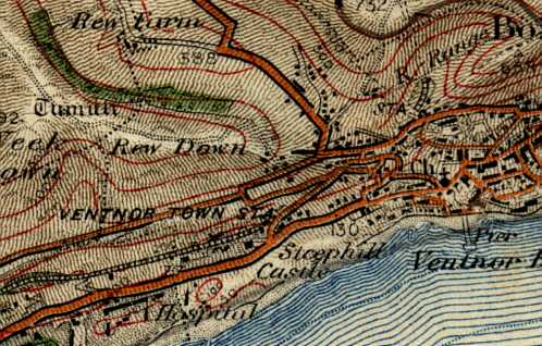
In this 1904 map, the Newport, Godshill & St. Lawrence Railway had recently been extended to Ventnor (opened 1st June 1900). The line enters the town from the west, running parallel between two roads. Careful examination of the contours however, reveals the roads and line are at very different levels as, like most of Ventnor, the land is on a steep gradient. The station is somewhat misleadingly named 'Ventnor Town' at this time although you will see the town is some way to the right on the map.
The 'Isle of Wight Railway' was somewhat more established in 1904, the 4 mile extension from Shanklin having been opened on 10th September 1866. It emerges from a tunnel under St. Boniface Down directly into the station some 294 feet above sea level.
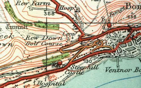
On 1st June 1923 Ventnor Town was more aptly re-named 'Ventnor West by its new owner, the Southern Railway. On this 1932 map it had been designated a 'halt' - odd as trains are generally required to stop at a terminus!
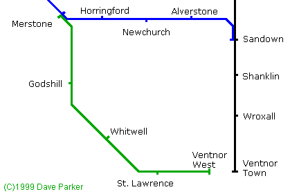
This map shows part of the Island's railway network with connections to Ventnor. The line north of Shanklin exists today after it was electrified in 1967. In fact new stations have been built at Lake (between Sandown & Shanklin) and at Smallbrook Junction (between Brading & Ryde). The line to Ryde via Shanklin was used far more than the Ventnor West branch. Most trains from Ventnor West ran only to Merstone Junction there passengers were required to change. Ventnor Council and others regularly complained and in some years a few token through trains (to Newport or sometimes even Cowes) were provided. However the line was never profitable and many trains ran empty. All this despite the line being considered as having some of the finest views from a railway carriage in the world.
The Ventnor West branch finally closed on 13th September 1952. Ordnance Survey do not allow reproduction of their maps within 50 years of publication so I cannot show how the area developed. By 1960 the Ventnor West Branch had no tracks left but the area was still undeveloped with a line of trees to the north of the track bed. Ventnor survived until 1966 when it was closed by Dr. Beeching's axe! The passenger line closed on 18th April that year while freight survived a month longer, closing on 16th May. The latest maps show both sites now re-developed as can be seen from the pictures below.
Ventnor Station
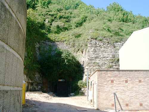
A view from the road with the Terminus Inn on the right of the picture. The chalk quarry provided an amazing 'amphitheatre' which resembled a model railway when viewed from the Down. The picture shows how the site has now been re-developed for commerce & light industry.
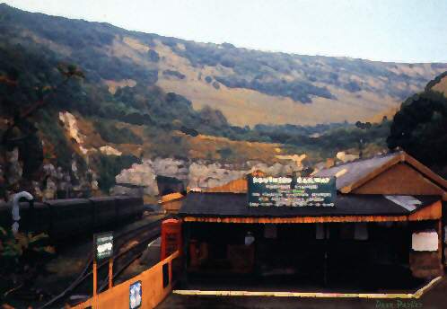
An artist's impression of the site from the same location in the 1950's - based on a photograph by W J Nigh & Sons.
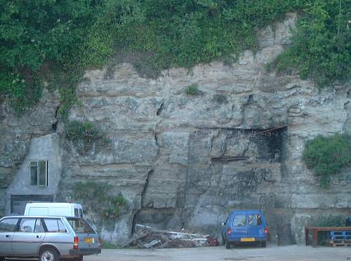
The caves in the sides of the quarry were utilised in railway days mainly by coal merchants. The caves can still be seen between some of the industrial units.
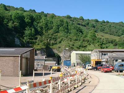
This would have been the view from the platform with the tunnel under St. Boniface Down only yards from the end of the platform.
Paul Milner used the previous photo to generate this interesting 'then & now' montage. Of course there was no Industrial Estate in the days when the railway was here (except for the Coal Merchants' caves on the left) and this area was taken up with sidings.
The tunnel is now used to import the town's water supply - the concrete container to the left is for this purpose.
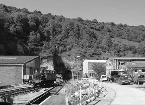
On leaving the station, the erstwhile traveller would have had a view very similar to this. The Terminus (left) would have been most welcome after the steep climb from the town and even longer climb from the beach!
Ventnor West Station
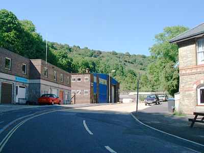
Ventnor's second railway was opened on 1st June 1900 - this photograph showing the location of the station was taken on 29th May 2000 - a mere two days from being one hundred years on! The view is looking east towards the buffer stops. The tracks would have run here with platforms to either side. The station building with the orange roof (now a private home) can be seen in the near distance.
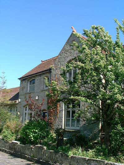
This was the station building, now a private home. It consisted of a refreshment room, booking hall, waiting room, staff room and two-storey stationmaster's residence, all built of grey Ventnor stone from the nearby quarry.
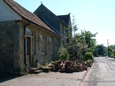
These views from the road would have opened onto the platform. Opened in 1900 as Ventnor Town, the station was re-named Ventnor West in 1923 by the Southern Railway. This area occupied the site of the former stables of the estate of nearby Steephill Castle. There were two platforms although one was hardly ever used. A few hundred yards from the station the line had a short branch into Ventnor Quarry (which once possessed its own narrow gauge tramway).
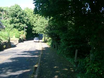
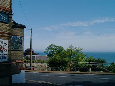
The station was 168 feet above sea level so there was a long walk down to the Sea (and probably a longer walk back up again)! This view (taken in 2000) is probably unchanged from closure of the line. It shows where the station road would have joined Castle Road close to its junction with Park Road (opposite Ventnor Park). Detailed maps show a footpath directly onto Park Road in addition to this exit.
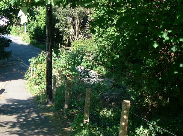
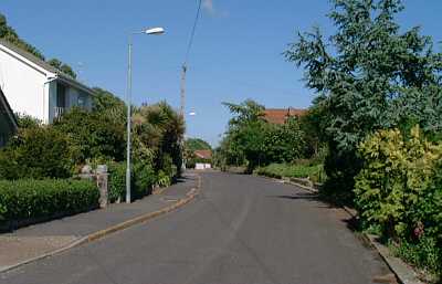
Another unchanged view. Passengers alighting would have had their first view of Ventnor similar to this. Probably their first clue that the 'Town' in the station name needed alteration!
More information on Ventnor's lost railways from Nick Catford.
Home | Introduction | Contents | Photos | Maps | Links | Quiz | History | Famous Islanders | Geography | Geology | Email
Books | Site Visitors | 1948 Guide | News | Phonebook | FAQ | Memories | Tunnel | What's on | Author | My other sites
|

|
|
|