Isle of Wight Nostalgia - Maps of the Undercliff between Niton & Blankgang
These two maps from 1904 and 1932 show the effects of the massive landslip ay Windy Corner in 1928 when millions of gallons of water remained undrained at the foot of Gore Cliff. This caused local rock falls and minor land slips and road was deemed unfit for use. Eventually a huge cliff fall was followed by a major landslip which lasted several days. Weird sounds were reported by witnesses and trips from the mainland were organised to watch the spectacle! The stretch of road was completely destroyed which caused traffic to follow an extensive diversion between Blackgang and Niton (right off these maps!). The road from Niton to Blackgang was not rebuilt until 1933 - you will need to buy your own Ordnance Survey map as I cannot show this - more recent maps are protected by copyright (if you're interested my book review page has links to recent maps from Amazon bookstore).
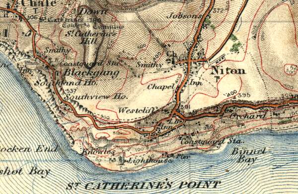
1904 Ordnance Survey map of Niton & Blackgang area.
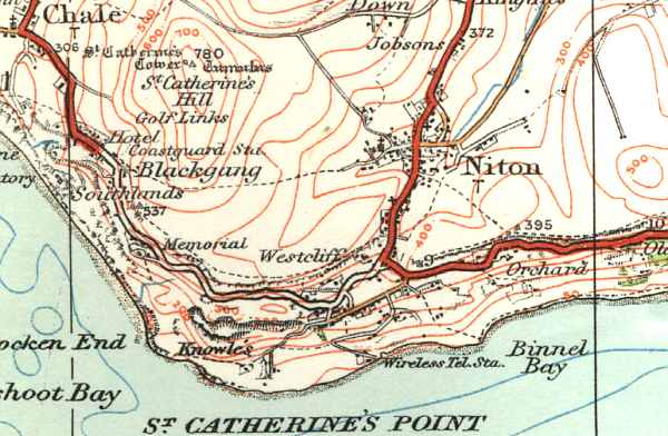
1932 Ordnance Survey map of Niton & Blackgang area showing extent of the 1928 landslip.